
Automated flood situation monitoring
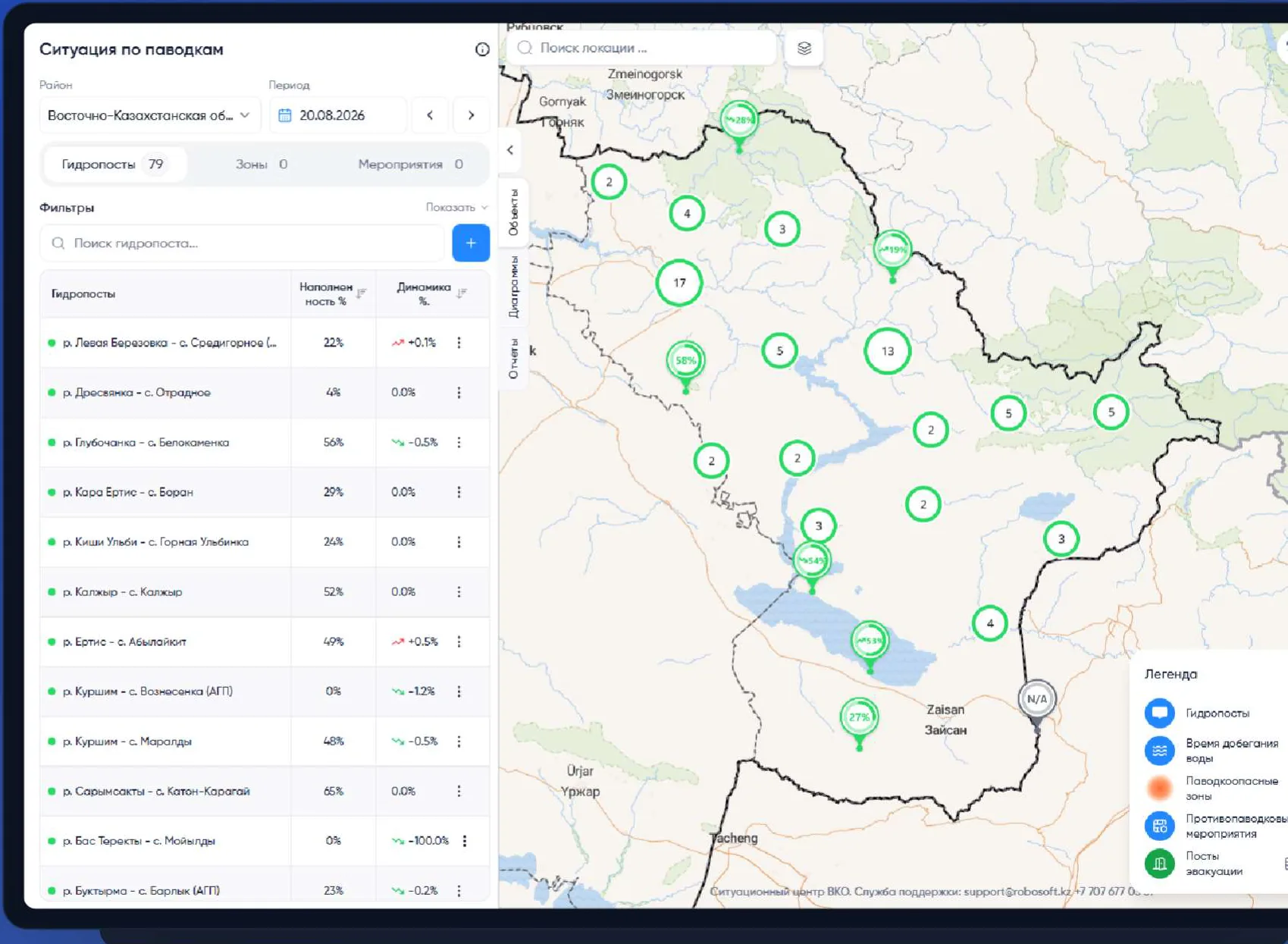
A network of automatic hydrological posts and a GIS module of the information system: continuous telemetry, a risk map, a short-term forecast and oversight of flood-prevention measures.
- Flood monitoring
- Automatic hydro posts
- Forecasting
- Akimat of the East Kazakhstan Region
- Supported by
- Protocol instruction No. 1/10 of 29.01.2025
- Basis
- IS “East Kazakhstan Situation Centre”, GIS module
- Platform
- August 2026
- Date
Flood data is collected by hand — decisions are made too late
- 01
Manual data collection
Reports are compiled by hand; the information goes stale before it reaches the decision-maker.
- 02
No real-time monitoring
Without automation the situation cannot be seen in real time — only on request.
- 03
No forecast
Forecasting relies only on monthly Kazhydromet forecasts; there is no local short-term forecast.
- 01→ solution choice
Akim, emergency department and the West Kazakhstan experience
We aligned the task with the region’s existing business processes, studied 3 operating hydrological posts in West Kazakhstan and selected a more cost-effective technical solution.
- 02→ regional experience
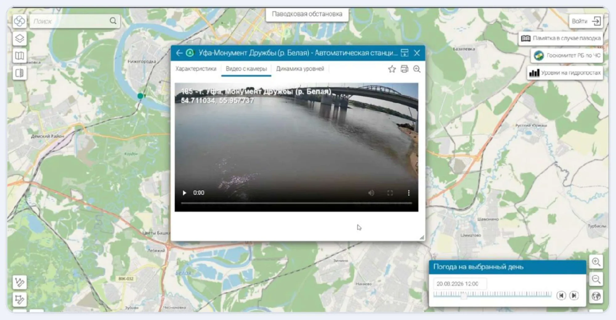
Site visit to Bashkortostan
We saw a working flood monitoring system in the field.
- 03
Agreement with Kazhydromet
Sensor set and installation points were agreed so the data is comparable with the state observation network.
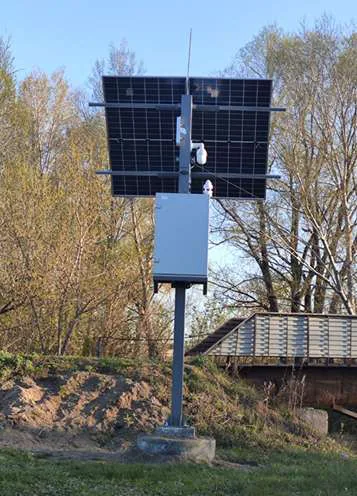
An autonomous post that measures the situation continuously
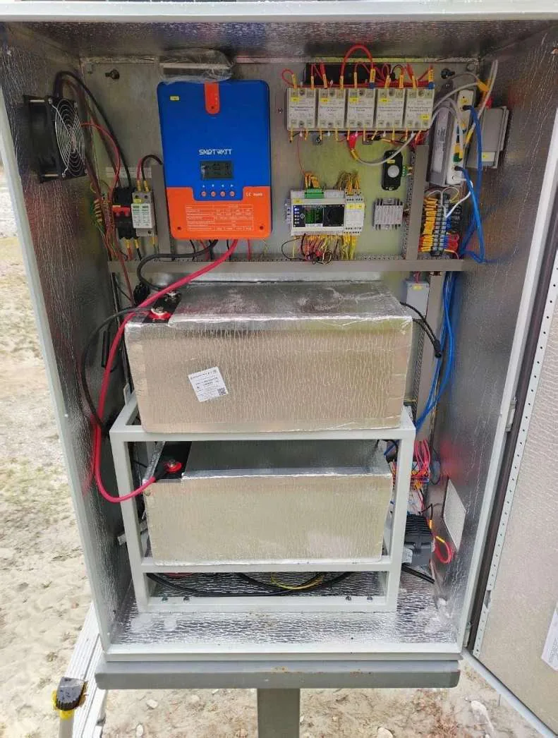
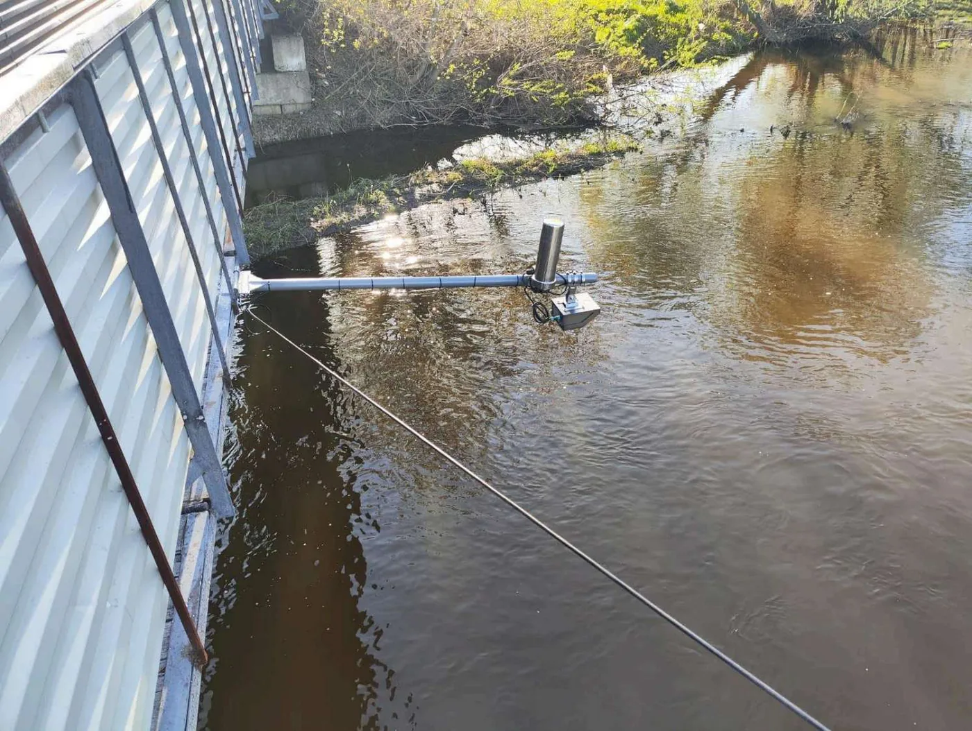
Water level and flow velocity
3parametersLevel, velocity, discharge.
Weather station
14parametersAir temperature, humidity, pressure, wind speed and direction, precipitation intensity, PM2.5 / PM10.
Structural integrity and position
12parametersAccelerometer and gyroscope, cabinet position, acceleration counters across 8 thresholds.
Power and autonomy
24parametersBatteries, charge and discharge, load, solar panels, daily figures and counters.
Service telemetry
8parametersGPS (satellites, coordinates, altitude, speed), controller and cabinet temperature, surface temperature.
61 telemetry parameters from every post in total — continuously, with no human involved.
- Starlink + GPRS
- solar panel + battery
- video surveillance
- GLONASS/GPS
- 26 posts to install
- sites — Kazhydromet posts
From sensor to management decision
Receives and stores data from all posts and shows the situation on the map and in charts.
Short-term water level forecast; historical series + climate and soil parameters.
- data refresh on the map
- Every minute
- observation points on the regional map
- 79
- automatic posts to be installed
- 26
- parameters from each post
- 64
Single situation map
Water level, discharge, ice conditions and criticality for every post; switching between automatic and manual data; settlements in the flood zone.
Charts and analytics
Indicator dynamics, trends, tabular data, water travel time.
Forecast and alerts
Short-term water level forecast, automatic alerts along notification routes.
Measures oversight
Tracking of flood-prevention works, evacuation points, regional readiness for the flood season.
Need a similar system?
Tell us about the task — we will propose a solution architecture, estimate the timeline and assess a pilot.